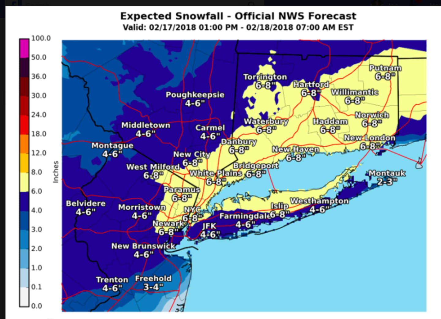

Up to 6-8 inches of snowfall accumulation is now possible in northern New Jersey, the lower Hudson Valley and Fairfield County, according to the most up-to-date projections for snowfall accumulation amounts, released Saturday morning by the National Weather Service. (See image above.)
Winter Storm Warnings and Winter Weather Advisories have been issued for the tristate area. They are in effect from 5 p.m. Saturday through 7 a.m. Sunday. (See second image above.)
Snowfall, which will start Saturday evening, will be heaviest between 10 p.m. Saturday to 2 a.m. Sunday.
Motorists should plan on difficult travel conditions and be prepared for significant reductions in visibility at times.
Some of the snow should melt Sunday, which will bring a mix of clouds and sun and a high in the mid-40s.
Check back to Daily Voice for updates.
Click here to follow Daily Voice Mt. Kisco and receive free news updates.