Matthew, the strongest hurricane to hit the Atlantic in nearly a decade, is now a Category 4 storm with maximum sustained winds at 155 mph and gusts up to 190 mph.
It briefly strengthened to a Category 5 hurricane late Friday to, become the strongest hurricane in the Atlantic Ocean since Felix in 2007, according to the National Weather Service.
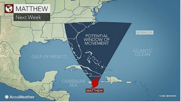
Matthew, which is now barreling toward Jamaica and Haiti, is then expected to make a dangerous northward shift and track from eastern Cuba to the Bahamas Tuesday. Several storms models predict the hurricane will then track at or near the East Coast rather than heading out to sea.
How significant an impact it could have on the East Coast and the Hudson Valley area will depend on Matthew's strength and proximity to the coast, according to AccuWeather. It's uncertain whether or not possible impacts will be direct from a landfall in the U.S. or indirect from a hurricane at sea, but the most likely track has the storm moving up east of the Atlantic Coast.
Matthew, which had been a tropical storm, became the fifth hurricane of the 2016 Atlantic Hurricane season on Thursday afternoon.
Check back to Daily Voice for updates on Hurricane Matthew's track.
Click here to follow Daily Voice Mt. Kisco and receive free news updates.