The advisory, which began at 3 a.m. Monday, is in effect until 6 p.m. Monday.
Some schools have announced early dismissals or closures. For the rundown, click here.
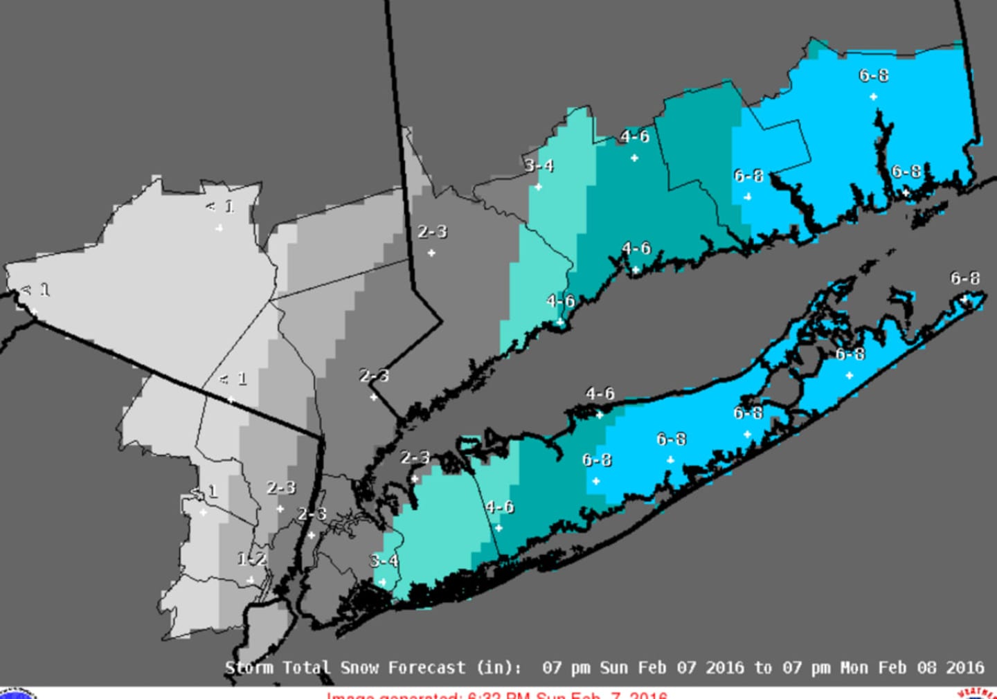
Snow is expected to develop Monday morning and continue through the afternoon. Approximately 2 to 3 inches of accumulation is now projected for Westchester and eastern Putnam, the weather service said. Parts of Northwest Westchester and Putnam could see only about 1 inch. Some areas farther south and east could see 4 inches of accumulation. (See snowfall forecast image above.)
Driving conditions could be hazardous with reduced visibilities and snow-covered roads.
Snow is most likely between 10 a.m. and 3 p.m., according to the National Weather Service.
The temperature is expected to fall to around 28 degrees by noon Monday with a wind-chill factor between 15 and 20.
Another round of snow is expected after 3 a.m. Tuesday with new accumulation of 1 to 2 inches possible.
There will be intermittent periods of snow during the day Tuesday and Wednesday, through Wednesday night.
A Winter Weather Advisory is also in effect for New York City. No advisories have been issued for Dutchess and Rockland counties. A Winter Storm Warning has been issued for Long Island.
Check back to Daily Voice for updates.
Click here to follow Daily Voice Mt. Kisco and receive free news updates.